Potentially Hazardous Wind Storm to Pulverize Maine This Week
Maine went from no snow on the ground to having snowbanks that you can barely see around, thanks to a slow moving winter storm that found the northeast at the exact right time. The atmospheric conditions invited that storm to drop more than a foot of snow on some areas, much to the delight of winter lovers.
Most of the largest snowfall amounts were coastal communities. The powerful bands of snow hovered over those areas for an extended period of time. But as Mother Nature giveth, she also taketh away. And much of that snow has a chance to disappear by the end of this week.
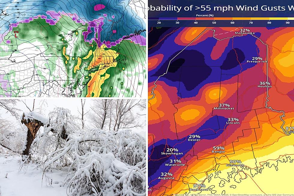
Shared on Twitter by Keith Carson, the News Center Maine meteorologist began to ring the alarm bells over this forthcoming storm late last week. It has many of the same earmarks as the devastating 'Grinch' storm that smashed into Maine on December 18.
Shared by National Weather Service Caribou on Twitter for central and northern Maine, the top concern will be the wind that shows up from the storm. It'll carry hazardous gust potential, with possible gusts reaching 55 to 65 miles per hour. Those areas of Maine will see the most snow, with 5-10 inches likely.
For southern and coastal Maine, the dangers will be two-fold. The wind gusts are expected to be even stronger, potentially reaching up to 70 miles per hour. But this storm is also like to turn to rain, quickly melting away snow and centering concerns around flooding. For context, the red and purple on the map above represent severe wind gust potential as Wednesday kicks off.
Because of the powerful wind gusts expected, power outages throughout Maine are likely. The only saving grace is that the temperatures from Wednesday through Saturday are expected to be above-average for this time of year. To make matters worse, there's a third possible storm coming with the possibility of a Saturday arrival.
LOOK: 50 cozy towns to visit this winter
Gallery Credit: Laura Ratliff
Visit 12 of Maine's Best Soup Spots to Warm Up Your Winter
Gallery Credit: Megan
More From 102.9 WBLM


